Kintore's Tuach Hill
A walk at Kintore train station.
A walk through Kintore and round Tuach Hill.
Kintore is small town in Aberdeenshire just fifteen minutes journey from Aberdeen on the trains to Inverurie & Inverness.

Kintore station is to the north of the town and ten minutes walk from the main square. The town became a Royal Burgh in the 12th Century and takes it's name from the Gaelic "Ceann-an-torr", head of the hill. The Town House dates from 1747 and the 19th Century parish church was designed by Archibald Simpson. Unusually, the gateway to the church graveyard is used as the town's war memorial.
There's lots of interesting history at Kintore - a stone circle, a ruined castle tower, and even an archaeological site full of iron age roundhouses and a Roman Camp. Rudy ditched history class for his visit on a hot summer's day and instead we enjoyed a picnic on Tuach Hill with it's shady trees and nearby stream.
Tuach Hill & Burn
Just to the south of Kintore is Tuach Hill (or Hill of Tuack on old maps). It's a very little hill but we found it to be an excellent walk, particularly good for good dogs. From the town square we headed along Kingsfield Road and turned right into an open access field with a clear path through the middle towards the hill. This was a great run-around field for Rudy but there is evidence that sheep visit sometimes so it may not always be suitable for dogs to be off-lead even with good recall.
The Tuach Burn runs around the bottom of the hill and while Rudy is fussy about what water he drinks he gave this wee burn his seal of approval. His fussy humans stuck to the bottled tap water we brought from Aberdeen though!
Into the trees and onto the hill.
At just over 80 metres (260 feet) in height Tuach Hill doesn't appear on any named list of Scottish summits but its a nice little hill and we liked it. Some of the paths were nearly overgrown in July but still well used and easy to follow. There was a choice of routes in places but for once, for this nice little hill, we headed to the very top!
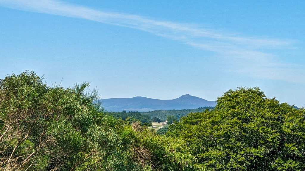
Tuach Hill is an isolated hilltop so even after such a short "climb" there are views across the countryside including of Bennachie to the northwest. At the top there's an Ordnance Survey trig point now nearly surrounded by gorse and also a Royal Observer Corps Monitoring Post - the entrance shaft made secure by concreting over the hatch. Rudy did wonder if that was a good alternative to a picnic table but no, we headed back down a little way to a more comfortable grassy bank.
Picnic Time
We found a very good place to sit for our picnic lunch, soft grassy bank with plenty of shade and a view over a little clearing in the middle of the trees. After he had finished his kibble and picked up all the crumbs from his human's sausage roll Rudy realised we weren't alone! His little nose was twitching and he was very focussed on something at the bottom of the slope. There was nothing there! Rudy insisted there was so we sat quiet and eventually human eyes and full zoom on the camera revealed a rabbit! Perfect after-dinner entertainment for a curious little terrier clipped safely on his lead!
Time for home
Even with Rudy desperately wanting to make friends with the faraway bunny rabbits we eventually had to head for a train home. We ended up missing out exploring some of the paths around the hill and more of Kintore but that just leaves us good reason to visit again.

Last chance today for a paddle Rudy! 
Rudy waiting for his train home.
Kintore has a very good community website at kintore.org.uk where you can find out more about the town and it's history.


